Platt National Park Historic District - Chickasaw National Recreation Area
How would you like to hike at a location that is equal in status to places such as Yellowstone, Sequoia, Yosemite, Mount Rainier, Crater Lake, and Wind Cave?! In 1906 Platt National Park joined the ranks of our nation’s national parks becoming the seventh location to receive the designation. Today, if you look for Platt National Park on a map, you will be unable to find it. In 1976 Platt National Park was merged with the nearby Arbuckle Recreation Area and rebranded Chickasaw National Recreation Area. Despite losing its status as a national park, the area is administered by the National Park Service.
Chickasaw National Recreation Area is located in Sulphur, Oklahoma and is nearly 10,000 acres in size. The area was set aside to preserve its mineral and freshwater springs. During the 1930s the Civilian Conservation Corps constructed spring pavilions, creek dams, swimming holes, picnic grounds, hiking trails, a road system, campgrounds, and a bison enclosure at the location. Numerous small waterfalls and the rush of water along Travertine Creek add to the uniqueness of this location. This review will focus on the hiking trails within the Platt National Park Historic District which include the Antelope Springs Trail, Travertine Creek Trail, and Bison Pasture Loop.
While there are numerous places you can park your vehicle, I parked in the lot for Travertine Nature Center. The center has exhibits on the park’s wildlife, geology, and history. You can also pick up a map and ask a ranger any questions you have before beginning your day of exploring. I began my day of hiking by heading west of the nature center on the Travertine Creek Trail.
The Travertine Creek Trail is approximately 1.5 miles in length. It runs parallel to Travertine Creek. This trail offers beautiful views of the creek and its many small waterfalls. The sound of rushing water can be heard as you hike this trail. The Travertine Creek connects to the Bison Pasture Loop.
The Bison Pasture Loop circles a 75 acre enclosure where the park’s bison herd resides. The loop is approximately 2 miles in length. A spur off the trail will take you to the top of Bromide Hill. After making your way up a series of switchbacks you will be rewarded with views of the park and the city of Sulphur.
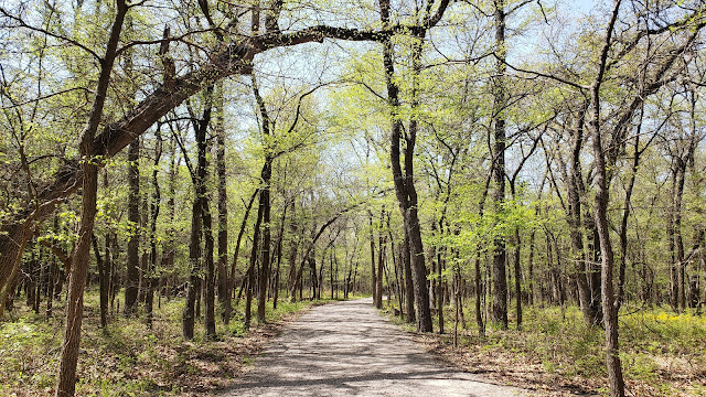
Most of the trails located within the Platt National Park Historic District of Chickasaw National Recreation Area are paved with crushed gravel. Some of the loops that extend from the main trails are in a more primitive state. Aside from the switchbacks going up Bromide Hill, the terrain is mostly flat. Regular signage directs you to landmarks and adjacent trails. The trails are covered by the canopy of the forest for almost their entire distance. Covered by the shade of the trees and plenty of water in tow, I found the trails tolerable on a 90°F day in June.
While you are hiking the trails, be sure to check out the various springs. With the exception of Antelope Springs, all of the park’s springs were transformed by the Civilian Conservation Corps. The CCC turned these springs into fountains and even built a pavilion atop one.
While the Texoma region is home to two national grasslands, three national wildlife refuges, and numerous state parks, Chickasaw National Recreation Area is the closest the area comes to having a national park. As of the time of this review (April 2022), day use of the park is free. However be warned, that it can be quite crowded during the weekends, especially during the warmer months of the year. Travertine Creek is a popular location for swimming and water recreation. Camping is available at a cost in several campgrounds located in the park.
Chickasaw National Recreation Area is not a remote location. It is not a pristine wilderness. However, the well-kept trail system, the CCC architecture, and the unique setting of Travertine Creek and its springs makes for a wonderful day of hiking and being outdoors.
More Information:
.jpg)


.jpg)


.jpg)


.jpg)
